What is a 3D Cut/Fill Grading Model?
Earthwork and site excavation are some of the highest-risk components of construction cost estimation. Even minor calculation errors in soil volume can result in massive budget overruns. Our 3D Cut/Fill Grading Models leverage advanced software (such as Carlson, Insite, and Trimble) to digitize site contours and generate exact soil movement profiles.
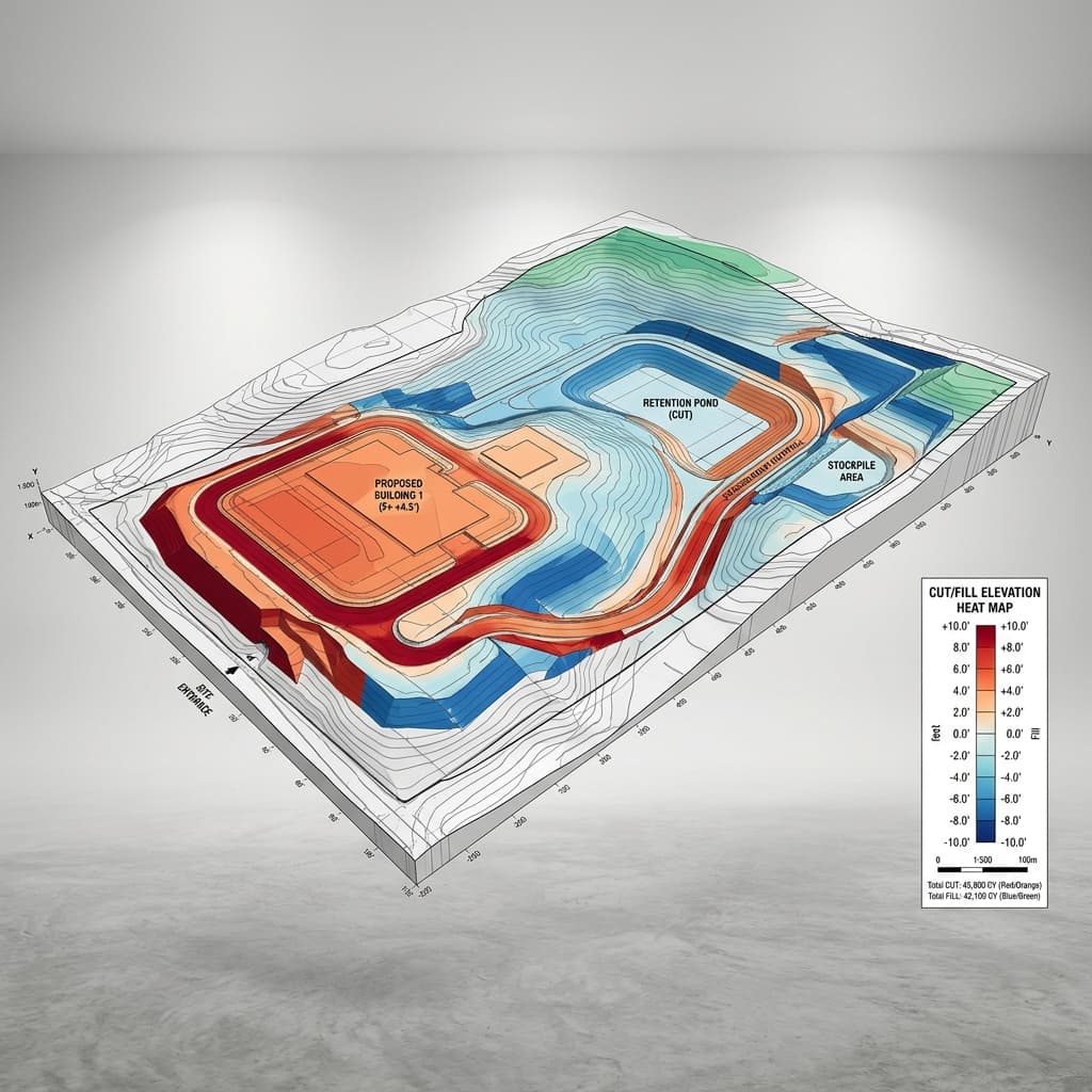
We construct digital terrain elevations comparing existing ground conditions against proposed building pads, retention ponds, and finish grades. The result is an elevation heat map detailing where dirt needs to be removed (cut) and where it needs to be added (fill).
What Our 3D Grading Services Cover:
- Existing vs. Proposed Elevation Comparison
- Precise Cut and Fill Volume Calculations
- Stockpile and Borrow Pit Analysis
- Building Pad and Trenching Takeoffs
- Retention Pond and Drainage Profiling
- Topsoil Stripping & Subgrade Adjustments
Benefits of 3D Earthwork Modeling
Accurate Soil Balances
Calculate precise quantities of soil, gravel, and sand. Minimize the cost of hauling dirt onto or off of the construction site.
Trimble/Carlson Machine Control
We can export our 3D surface files (.DXF, .TTM, .XML) directly into your GPS-guided bulldozers and excavators for seamless field grading.
Visual Risk Mitigation
Identify subgrade challenges, rocky formations, or high water table risks visually before your heavy equipment even arrives on site.
Need Accurate Earthwork Volumes?
Send us your grading plans and survey files (CAD/PDF) today to get a precise 3D grading model estimate.